
Position yourself as an expert in your field
Title
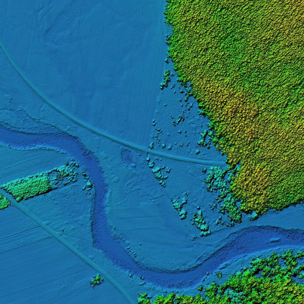
What is CyberGIS and Geospatial Data Science?
CyberGIS and geospatial data science is a diverse and fast-growing field that can lead to many career paths, and there is an increasing demand for highly-skilled professionals. The field combines geographic information systems (GIS) with cyberinfrastructure, data science, and advanced computational techniques to tackle complex geospatial challenges by analyzing, modeling, and visualizing geospatial data in a scalable and efficient manner.
While students come from different academic and professional backgrounds, they share a passion for cutting-edge technology, a curiosity for spatial data, and a desire to make a significant impact on our future. Through our programs, they will acquire the advanced knowledge and critical skills in applying geospatial big data, methods, and technologies to solve real-world problems in a wide range of application domains such as energy, agriculture, globalization, health, sustainability, and natural resources. Specific areas of emphasis include cyberGIS and high-performance geospatial computing, geospatial visualization and visual analytics, geospatial artificial intelligence and machine learning, geospatial big data analytics, and geospatial information science and systems.
Apply to start in the Fall, Summer or Spring semester.
Request More Information
Choose Your Pathway

Graduate Certificate Program
The CyberGIS and Geospatial Data Science graduate-level certificate is a 12-credit program allowing a student to gain more skills in a growing field as well as obtain micro-credential that can be added to a resume and other social media applications. It also provides an ideal bridge into the 32-credit hour online master’s degree should students desire to continue on for an advanced graduate degree.

Master of Science Degree Program
The M.S. in CyberGIS and Geospatial Data Science is designed to meet the high demand for advanced expertise in areas such as geospatial artificial intelligence, geospatial visualization and visual analytics, data intensive computation using big geospatial data, geospatial data processing and analysis in Python and R, as well as fundamentals and principles of geographic information science and CyberGIS.
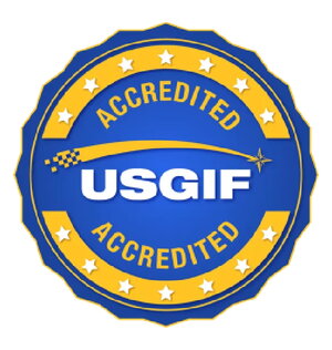
USGIF Accredited Program
The United States Geospatial Intelligence Foundation (USGIF) accreditation of collegiate Geospatial Intelligence Certificate and Degree Programs benefits students, colleges, universities, industry, government, and the GEOINT Community at large by ensuring current hiring needs are reflected in cross-disciplinary classroom coursework.
A USGIF GEOINT credential proves to hiring organizations that the institution offering programs has the needed foundational knowledge and technical skills as well as critical thinking, reporting and synthesis abilities to successfully contribute to the GEOINT Community.
The University of Illinois at Urbana-Champaign is one of only 23 collegiate programs across the nation who has earned this accreditation level.

Build on your military achievements
A master's degree or graduate certificate in CyberGIS and Geospatial Data Science is a powerful way to transform the valuable knowledge, skills, and experience you gained in your military career into a lucrative and rewarding career in the public or private sector.
“The CyberGIS and Geospatial Data Science online program has allowed me to enhance my 12 years of experience in the GIS field through various languages and software, enabling me to excel beyond my peers.” – Chief Warrant Officer Jay Smith, CyberGIS M.S. graduate and Geospatial Engineer Technician in the U.S. Army.
Frequently asked questions
What skills will students gain?
- Python programming
- Data modeling
- Data visualization
- ArcGIS
- Remote sensing
- R programming
- Geospatial AI and Machine Learning
- Spatial analysis
Where do graduates get jobs?
- U R Rao Satellite Centre (URSC), ISRO (India)
- United States Marine Corps
- United States Army
- EDP University of Puerto Rico
- Allen Institute for AI, Seattle, WA
- United States Department of Defense
- Stride, Inc.
- Ameren, Inc
- Management Development Institute, Gurgaon (India)
What types of careers do graduates get?
- Analysts
- Data scientists
- Environmental engineers
- Research programmer
- Scientists
- Consultants
- Government agency positions
- Military
- Educator
- Software engineer
- GIS program manager
- GIS developer
Why choose the University of Illinois?
- Top-ranked public university
- Leader and innovator in online education
- Birthplace of cyberGIS and a global leader in geospatial data science and education
- Courses taught by distinguished instructors who are experts in their fields
- 100% online
- Enrollment in spring, summer or fall semesters
- Opportunities to network with worldwide industry experts
When are the application deadlines?
Master's degree
Apply by:
- December 15 to start in the Spring semester
- May 15 to start in the Summer Semester
- August 1 to start in the Fall semester
Certificate
Apply by:
- January 10 to start in the Spring semester
- June 1 to start in the Summer Semester
- August 15 to start in the Fall semester
Online CyberGIS and Geospatial Data Science
Get a sneak peek at the CyberGIS & Geospatial Data Science online programs.
Jay Smith – Fall 2024 Master of Science Graduate
U.S. Army Chief Warrant Officer 2 - 1st Special Forces Command Serves as a Geospatial Engineer Technician “The CyberGIS and Geospatial Data Science online Master’s program has allowed me to enhance my 12 years of experience in the GIS field through various languages and software, enabling me to excel beyond my peers.”

Audrey Weirda - Spring 2025 Master of Science Graduate
"The program becomes very personalized once you reach your capstone project. I really enjoyed the capstone project, as it was a chance to apply multiple aspects of my knowledge and work with other organizations. I really enjoyed working with the faculty-they are responsive and accommodating."

Patrick Johnson - Spring 2025 Master of Science Graduate
“I gained valuable insights from every class, but I particularly enjoyed: Foundations of CyberGIS & Geospatial Data Science Introduction to Remote Sensing Advanced Spatial Analysis These courses were especially engaging and directly applicable to my professional work. It was very rewarding to see my capstone project evolve into my first publishable paper.“

Pratheeksha Nayak- Spring 2025 Master of Science Graduate
“I like the format of the courses – weekly labs/assignments and a final project. Although, it gets hectic at times, the format provides an avenue for hands-on learning. The instructors are very approachable. They are quick to resolve any issues faced during the course and are very accommodating of student requirements.“

Jonathan Correa Varela- Spring 2025 Certificate Graduate
"Prof Portelli is amazing! She helped me understand how to use Jupyter Notebooks and Python scripts to gain further inside into geospatial analysis. In this program just with 3 classes you will learn enough to create your own projects and put your skills to work."

Jake Dennison—Spring 2024 Master of Science Graduate
The faculty did a great job of putting student priorities first while exposing me to many different types of software, technology, and processes that are beneficial to me and my future career goals. It was also great to learn about innovative approaches to data science and this program helped me develop excellent problem-solving skills

Nakul Gupta--Spring 2024 Master's Degree Graduate
Graduating from the MS in CyberGIS and Geospatial Data Science program at the University of Illinois, Urbana-Champaign (UIUC), has been an unparalleled journey. The online format provided latitude to attend to my work commitments at MDI Gurgaon, and at the same time make the most out of the rigorous, cutting-edge curriculum that UIUC is known for. The courses, designed with an eye towards the future of geospatial science, have equipped me with a unique blend of skills in geographic information systems, data analysis, and spatial thinking. The faculty, who are leading experts in their fields, were not just educators but mentors who were genuinely invested in our success. I am confident that the knowledge and experiences I've gained will be pivotal in my professional journey, opening doors to opportunities in research, policymaking, and technology innovation